
Final Presentation CHARLI Project
Last Updated: 27/01/2026 15:48 Created at: 26/01/2026 11:23
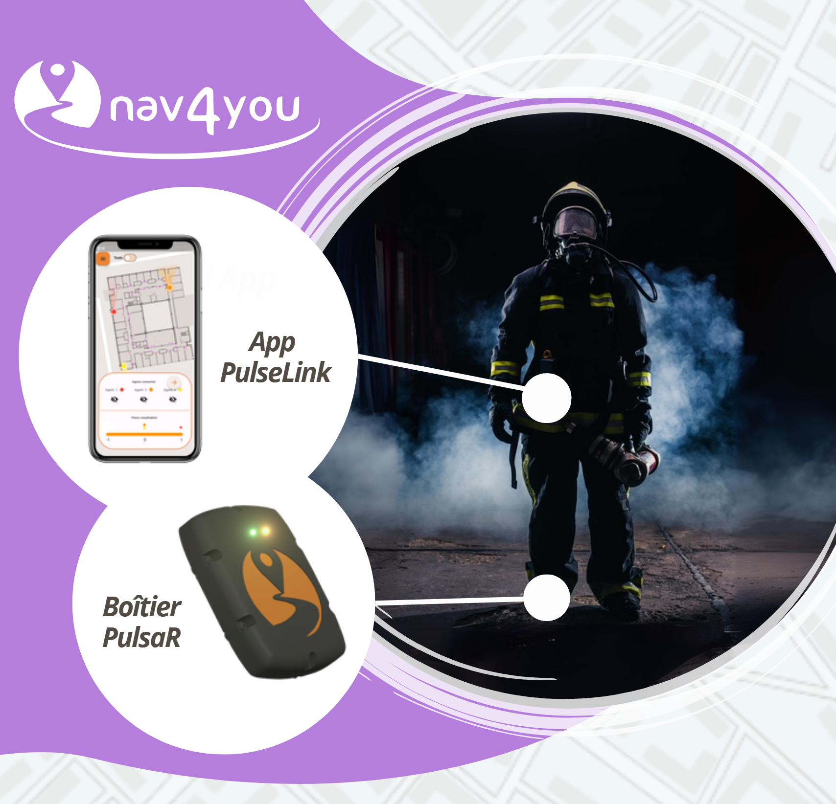 On the 29th of October 2025 nav4you and the GEOLOC laboratory presented the results of their work on an innovative foot‑mounted localisation system designed to protect first responders operating in complex, GNSS‑challenged environments.
The project aimed to deliver a complete real‑time location solution, operating indoor and outdoor, without reliance on infrastructure, integrating inertial, magnetic, GNSS, and AI‑enhanced processing.
The system was developed, tested, and validated through a structured programme including:
- Enrichment and redesign of AI‑based inertial algorithms (step detection, movement patterns such as ramp, scouting, crawling, knees, etc.)
- Development of new initialization techniques (gyrocompassing, maytagging, manual orientation correction) for operation under magnetic disturbances
- Real‑time transposition of patented GNSS velocity algorithms from MATLAB to Python, enabling operational TDCP processing with significantly reduced computation times (from 71.3s to 46.56s for 3804 epochs)
- Development and testing of a new GNSS‑based AI model using 27 datasets in urban environments (XGBoost + Optuna), with partial performance improvements but weak correlations in some cases
- Integration of indoor maps, post‑intervention reconstruction tools, and real‑time temperature heat‑mapping for hazard awareness
- Hardware redesign into a lighter, smaller, modular architecture: foot device, compute device, gateway, and later full transition toward a smartphone‑based compute platform to reduce cost and simplify the ecosystem
- Production and validation of 15 units and execution of extensive experiments in realistic firefighter scenarios (2 km mixed indoor/outdoor path, U‑turns, crawling, duck‑walking, window crossing)
Key results include:
- Major accuracy improvements: algorithmic error reduced from 26 m to 10 m, endpoint error from 90 m to 25 m, and T0 baseline performance exceeded (final algorithms achieved 0.8% vs the 1% target)
- Improved plot consistency due to updated magnetometer processing and enhanced handling of complex firefighter movements through new AI models
- Validated functionality across all hardware components under realistic conditions, confirming robustness and operational readiness
- 70% reduction in device volume, 10‑hour autonomy, and introduction of BLE, LoRa, 4G/5G, MQTT server, PulseRescue software, PulseLink app, and PulsaR device in the final architecture
The project co-funded under NAVISP Element 2 concluded with the successful design and validation of a complete real‑time localisation system without infrastructure. The modular approach enables broad applicability across emergency response use cases. Next steps include commercialisation, production scaling, and deployment planning. You can access the slides here.