
GNSS Monitoring and Interference Detection at Romanian Airports
Last Updated: 05/05/2023 08:15 Created at: 05/05/2023 08:15
Final Presentation of NAVISP Project EL3 016 now available
On Friday, April the 27th, 2023, Romanian InSpace Engineering (RISE) presented the results of the NAVISP project “ECHO - GNSS Monitoring and Interference Detection Study and Pilot System Deployment at Romanian Airports”. The presentation delivered was met with significant interest from both industry and research institutes, with an attendance of approximately 40 people.
As satellite-based services become more prevalent, it is crucial to prioritize the safety and efficiency of aircraft operations by mitigating the impact of GNSS disruptions and performance degradation. GNSS signals are vulnerable to interference, intentional or not, which can jeopardize smooth operations. Therefore, to ensure the suitability of GNSS for aircraft operations, continuous monitoring of their performance is necessary.
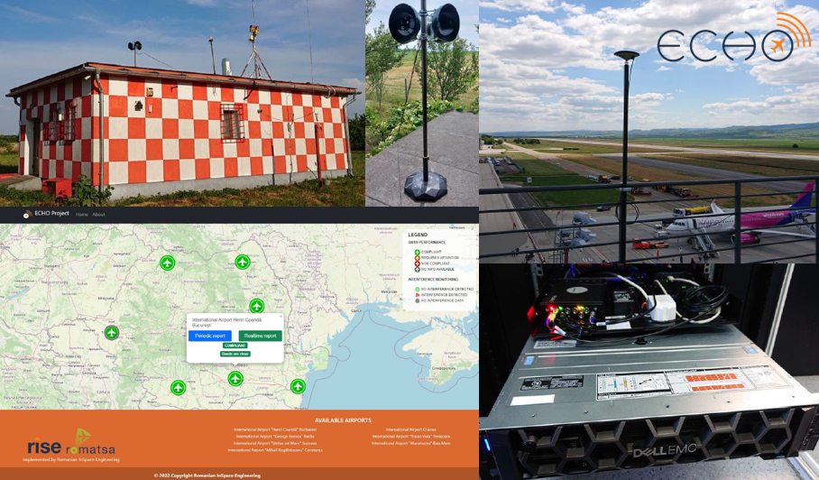
The ECHO project has successfully enhanced GNSS operations in Romania by adhering to tailored recommendations from the International Civil Aviation Organization (ICAO). The project's outcomes ensure compliance with international standards for monitoring GNSS signals and detecting interference at airports with commercial operations served by the Romanian Air Traffic Services Administration (ROMATSA). This was achieved through the establishment of an operational pilot network of ECHO monitoring stations at seven Romanian airports, each equipped with GNSS Signal-in-space (SIS) monitoring stations and interference detection and localization stations. The system can monitor a range of RF environments, including those with non-voluntary and voluntary interference such as jamming and spoofing. The pilot system for monitoring GNSS signals has a real-time component that updates on GNSS performance and interference presence. Additionally, it automatically generates periodic reports on GNSS key performance indicators. One of the monitoring stations at an airport was also tested for interference detection. To ensure ease of access to data, the project has developed a user-friendly software application that enables users to access GNSS performance reports from all stations. This feature provides independent reports for all EGNOS users, not just those in aviation.
The ECHO project not only increased airport safety with its high density of interference monitoring stations but also has significant market potential due to its low-cost monitoring stations with a modular design for easy installation and upgrades. With a user-friendly application, the system provides periodic verification of GNSS performance and real-time alerting of performance degradation. It also has data storage capability for GNSS measurements and signal snapshots for at least 30 days, operates continuously 24/7 with remote access, and receives continuous updates in line with GNSS evolutions and ICAO recommendations. The result is a highly reliable and effective system for monitoring and ensuring safe GNSS-based operations.
The ECHO system is not just limited to GNSS performance monitoring, it also has the capability to detect interference threats at each airport, thus increasing safety and security measures. Moreover, the user application has been designed to integrate smoothly with the operational environment of the Romanian Air Traffic Services administtration (ROMATSA), ensuring a seamless user experience. Additionally, the system is scalable and maintainable at all Romanian airports, aligning with international regulations to support space-based air navigation operations. With all these features, the ECHO system offers a dependable and effective solution for GNSS monitoring and maintenance at airports, ultimately contributing to the safety and efficiency of the aviation industry in Romania.
The project was part of NAVISP Element 3, which aims to support ESA member states' national navigation, positioning, and timing activities along the entire value chain to develop and promote products, applications, and services based on GNSS and, more broadly, PNT systems, which are coherent with national strategies.
More detailed information can be found in the slides of the Final Presentation.