
PLUTO: Proactive Road Maintenance and Condition Monitoring
Last Updated: 11/08/2025 07:49 Created at: 24/02/2025 09:43
Slides of EL2-146 now available
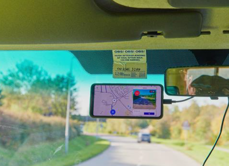
On Wednesday, February 19th, 2025, Pluto Technologies presented the results of the NAVISP EL2-146 project, focused on using satellite location data and AI-based image analysis to enhance road maintenance. The project aimed to provide municipalities with smarter tools for monitoring road conditions and prioritizing maintenance tasks.
The key features of their newly developed product are:
- AI-Based Detection: PLUTO developed models to detect and classify road damages (e.g., cracks, potholes) and inventory (e.g., signs, poles) with detailed conditions like severity and tilt. This all runs locally on smartphone chips.
- Map Matching: Improved GNSS-based data alignment with road maps using OpenStreetMap for better location accuracy and reduced ambiguities.
- Task Management: Automated data collection and integrated it into workflows via email notifications, enabling faster hazard prioritization and task creation.
- GNSS Data Analysis: Explored raw GNSS data post-processing but found that smartphone-native sensor fusion often provided more robust results.
Future plans include refining AI models, enhancing backend systems, and expanding interface functionalities to better support specific workflows, solidifying Pluto’s role in proactive road maintenance solutions.
The project was part of NAVISP Element 2, aimed at supporting industrial competitiveness and stimulating innovation in the PNT sector.
The slides are accessible here