
Precise Positioning for mass-markets: Optimal data dissemination demonstrator
Last Updated: 29/11/2023 13:30 Created at: 29/11/2023 13:30
Final Presentation of NAVISP Project EL1-036 BIS now available:
On Monday, Friday November 24th, 2023, Teria together with GUIDE-GNSS, ATDI and Geo++ presented the results of the NAVISP EL1-036 BIS project "Precise Positioning for mass-markets: Optimal data dissemination demonstrator”. Around 50 people joined the online event and the following discussion.
Until recently, high-precision positioning technologies such as Real-Time Kinematics (RTK) and Precise Point Positioning (PPP) have been primarily developed for professional use due to their cost prohibitive nature for mass-market adoption. However, there has been notable progress in making these technologies more accessible for widespread consumer applications in the past few years. While multi-band Global Navigation Satellite Systems (GNSS) show promise in enhancing user experience across various consumer scenarios, their standalone capability may fall short in meeting the stringent accuracy demands of automotive and industrial applications. Augmenting these systems with accurate techniques becomes imperative for ensuring robust and precise performance in these specialized domains. A prospective approach involves harnessing recent GNSS advancements alongside future terrestrial wireless networks to disseminate multi-GNSS augmentation services in real-time at reduced costs. These terrestrial networks, primarily evolved for multimedia content delivery such as Multimedia Broadcast Multicast Service (MBMS) technology, hold potential for augmenting and enhancing the dissemination of high-precision location data.
In this context, the project's concept involved dedicating a segment of the wireless network capacity to accommodate specific content. This allows Mobile Network Operators (MNO) to transmit an easily scalable, unified data stream to all mobile users within a specific area instead of sending separate streams to each user individually. The primary objectives of the activity were to:
- Create a demonstration platform that utilizes terrestrial broadcast technologies to offer high-precision multi-GNSS data (like RTK, N-RTK, PPP) to everyday users.
- Validate a complete terrestrial broadcast service concept in real-world operational settings, such as implementing PPP for a vehicle on a highway.
- Showcase the cost-effectiveness of using cellular signals or similar broadcast methods instead of individual data links over IP networks.
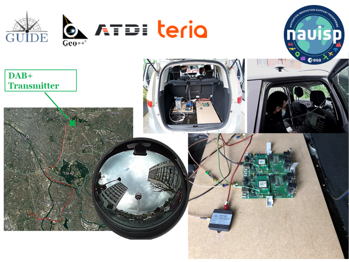
At the end of the project, the outcomes encompassed the conceptual development of an innovative testbed demonstrating the terrestrial broadcast of high-precision multi-GNSS assistance data via cellular signals and similar. Within the testbed, a state-of-the-art DAB+ demonstrator underwent testing in various scenarios like Peripheral Roads, Highways and Urban Environments. Results showed accuracy similar to NRTK near the transmitter, but hardware and software limitations impacted reception, especially in dynamic conditions and farther from the transmitter. The use of a single transmitter limited coverage beyond 10km, highlighting DAB+'s limitations, including poor signal availability, frequent outages and susceptibility to interference. The SSRZ assistance data, developed by GEO++, a flexible, open SSR correction format, emerged as a resilient solution, offering accuracy close to NRTK and rapid convergence time.
The project was carried out in the scope of NAVISP Element 1, which is dedicated to technology innovation of the European industry in the wide PNT sector.
More detailed information can be found in the slides of the Final Presentation.