
DANGO-Danish National Galileo Overlay
Last Updated: 15/10/2024 06:35 Created at: 14/10/2024 07:56
Final Presentation of NAVISP Project EL3-008 now available:
On Thursday, October 10th, 2024, the Technical University of Denmark (DTU) together with Aalborg University (AAU) presented the results of the NAVISP EL3-008 project "DANGO (Danish National Galileo Overlay)"
The demand for high-accuracy Global Navigation Satellite System (GNSS) applications is expected to grow rapidly, driven by advancements in autonomous navigation for cars, drones, and other systems. A key enabler for this development is the European GNSS (EGNSS), particularly through the Galileo High Accuracy Service (HAS), which offers free PNT corrections. By leveraging Precise Point Positioning (PPP) techniques transmitted via the Galileo E6-B signal, users can achieve positioning accuracy within 20 cm. However, these corrections are provided within the global geodetic reference frame, known as the Galileo Terrestrial Reference Frame (GTRF), which may not directly align with the national reference frames that many users require for tasks such as mapping, 3D city modelling, or infrastructure planning. This discrepancy necessitates transformations from GTRF to local or national reference systems to ensure accuracy at the user level.
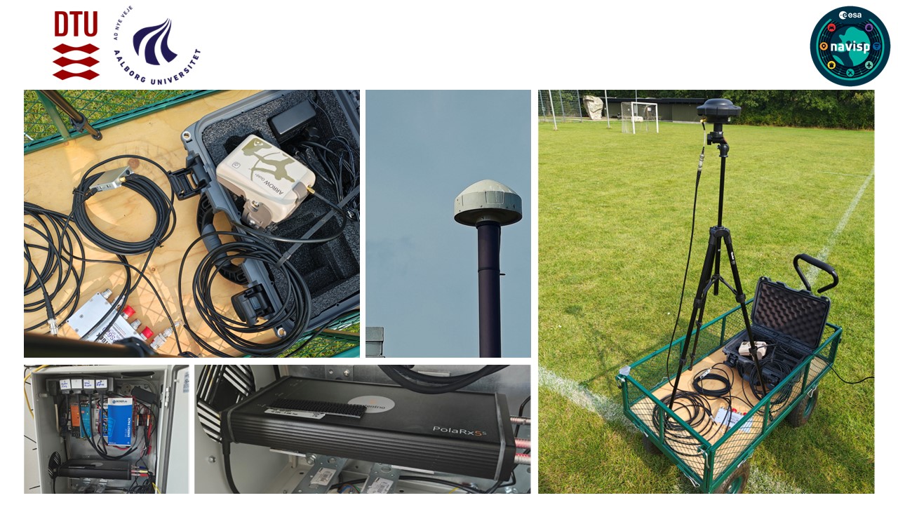
The DANGO project, launched in Denmark, aimed to create an advanced infrastructure for direct transformations from the Global Terrestrial Reference Frame (GTRF) to the Danish national reference frame (ETRF92), specifically for high-precision geospatial applications. The project's primary objective was to calculate and continuously update the Helmert transformation parameters, which facilitate the conversion of coordinates between different reference frames or coordinate systems. This enables users to perform real-time transformations with centimeter-level accuracy in positioning. The process utilized data from Denmark's national Continuously Operating Reference Stations (CORS) network and included the installation of three dedicated DANGO reference stations in Lyngby, Esbjerg, and Aalborg.
A key focus of the project involved assessing the performance of GNSS receivers capable of directly utilizing Galileo HAS corrections, in comparison to standard Real-Time Kinematic (RTK) GNSS receivers. Extensive testing was conducted to evaluate the efficacy of HAS corrections under a range of environmental conditions, including open sky, urban, and semi-urban environments, with the goal of assessing receiver performance across diverse real-world scenarios. One of the key technical challenges the DANGO project tackled was the transformation of positions from GTRF to the Danish national datum, ETRS89DK. Traditionally, these transformations require multiple steps, including intraplate motion corrections, through a chain of Helmert transformations. The DANGO approach simplified this by computing direct transformation parameters, bypassing the need for such complex chains. The project’s innovations led to the calculation of a set of seven transformation parameters, which could be used by users to transform their GNSS-derived positions in real-time with minimal residual errors, typically within millimetres and not exceeding 2 cm. The project also verified the accuracy of the corrections across the entire region of Denmark.
By the conclusion of the project, the infrastructure for high-accuracy GNSS applications in Denmark was well-established. It delivered a dependable set of Helmert transformation parameters that can be updated to reflect changes in reference stations or geodetic frames. The system's modular design ensures flexibility and scalability for future applications. Additionally, the project set the stage for the continued use of Galileo HAS corrections in Denmark, with plans to expand its capabilities for broader high-accuracy navigation services.
The project was part of NAVISP Element 3, aiming to support national PNT strategies by providing support per country and possibly per domain for the development and promotion of products, applications and services based on PNT systems to foster national and international cooperation.
The slides are accessible here.