
NAVISP Demonstrates VDES-R Accuracy in GNSS-Interfered Romanian Waters
Last Updated: 26/08/2025 08:24 Created at: 25/08/2025 13:46
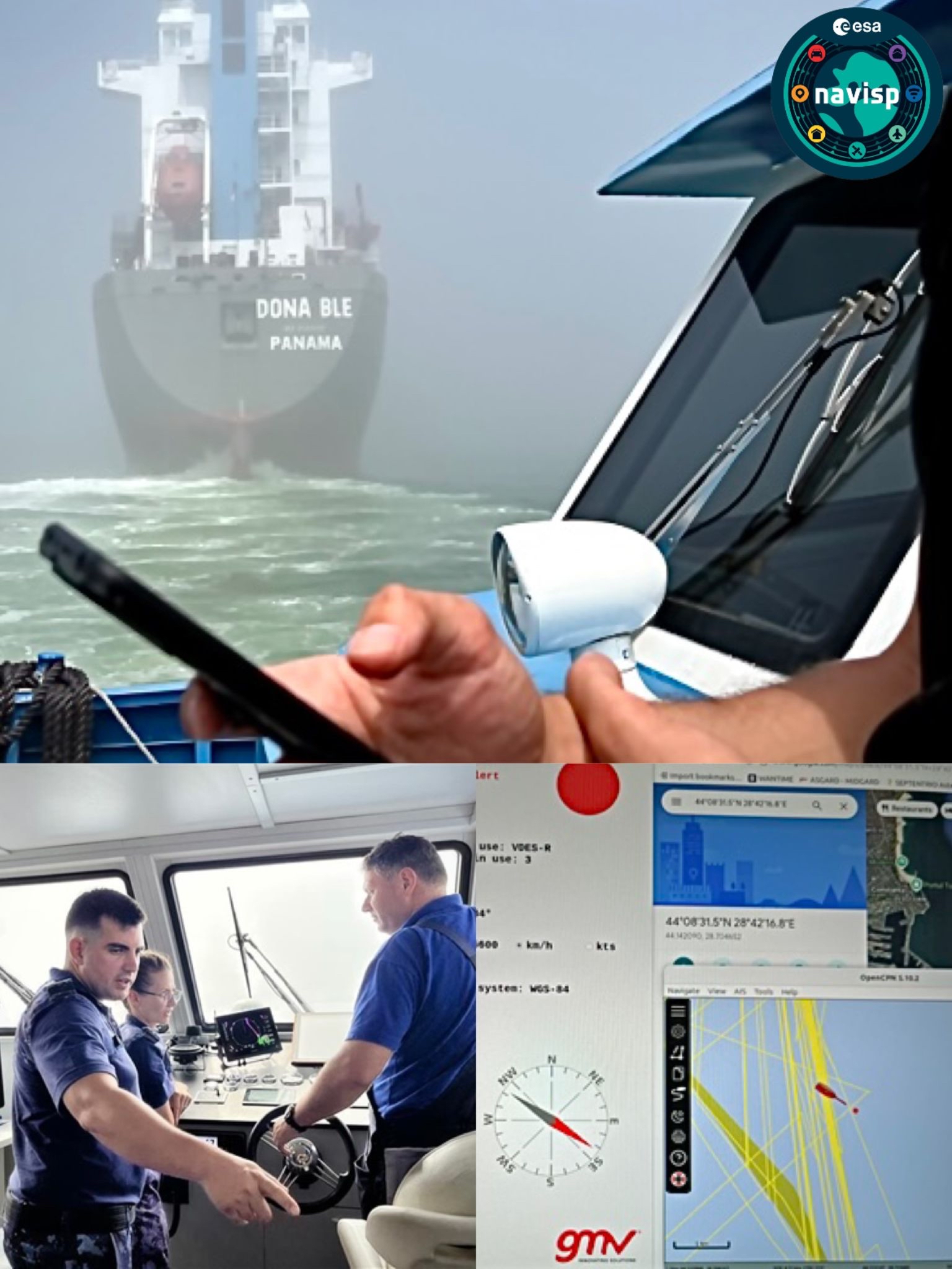
At the end of July, under foggy conditions in Romanian waters off the coast of Constanța, a live demonstration of VDES-R positioning was conducted as part of the NAVISP project RIPTIDE, led by GMV Innovating Solutions S.R.L. in collaboration with the Romanian Maritime Hydrographic Directorate (MHD) and the Romanian Space Agency (ROSA).
This maritime area is well known for frequent GNSS interference, including jamming and spoofing, which can result in position errors of several kilometers. The timing of the demonstration coincided with one of these interference episodes, providing a real-world stress test for the technology. NAVISP officials observed firsthand how conventional GNSS-based devices, such as mobile phones, reported inaccurate positions—placing the vessel inland while it was actually navigating one kilometer offshore.
Despite these challenging conditions, the VDES-R system consistently delivered accurate position fixes, with errors remaining below 10 meters. In one notable moment, officers from the MHD compared the VDES-R output displayed on the RIPTIDE interface with radar-based positioning data. The two sources correlated closely, reinforcing the reliability of VDES-R as a resilient alternative in environments where GNSS cannot be trusted.
This demonstration highlights the potential of VDES-R to enhance maritime safety and navigation integrity in interference-prone regions. Final results and technical insights from the RIPTIDE activity will be presented in October 2025.
For more information on EL3-026, please click on this link: ESA's NAVISP Programmes