
Novel concept for independent PNT using VDE-SAT for critical navigation at sea
Last Updated: 30/01/2024 08:42 Created at: 30/01/2024 08:37
On Thursday, January 25th, 2024, Space Norway AS presented together with its partners from Kongsberg Seatex the results of the NAVISP EL3-010 project "Independent Critical Navigation (ICING)". Around 50 people from industry and research institutes followed the interesting presentation and the subsequent interactive Q&A session.
Growing dependence on Position, Navigation, and Timing (PNT) information in critical infrastructure, with GNSS satellites as primary sources, raises concerns due to the vulnerability of their signals to both unintentional and intentional disturbances. Deliberate interference, such as jamming, poses a significant threat, with potential economic ramifications, as evidenced by UK government estimates indicating a loss of GNSS signal for five days could cost the maritime economy over one billion pounds. The maritime industry, particularly reliant on GNSS, faces vulnerabilities in electronic charting systems, collision avoidance through automatic identification systems (AIS), and onboard GNSS receivers. At the same time, incidents disrupting GNSS signals have increased globally, utilized not only in conflicts but also in illegal fishing operations. Simultaneously, the push for maritime digitalization and autonomous shipping amplifies the demand for complementary PNT systems to ensure timely and reliable navigation information. A complement to the existing GNSS signals can be provided by using terrestrial R-mode based on AIS, VDES or maritime radio beacons. The operational areas of this service could be extended by using a ranging signal from satellites.
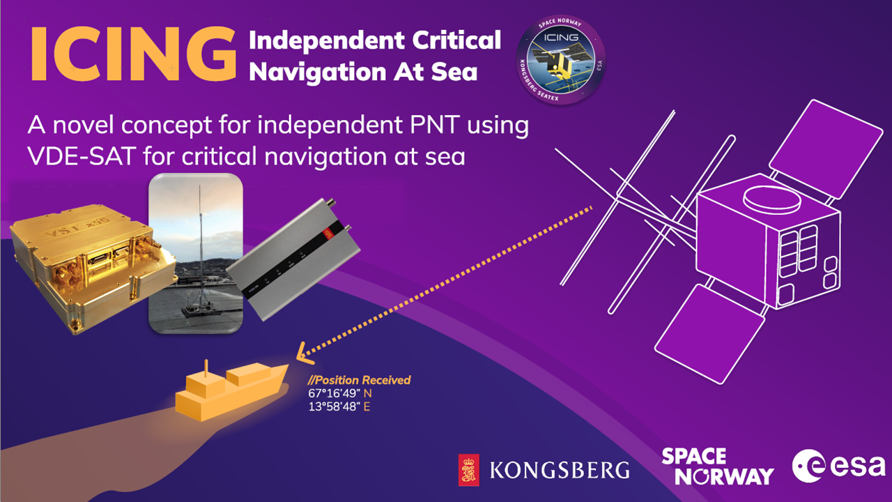
In this context, the project aimed to showcase satellite based VDES Ranging as a pivotal component of a forthcoming complementary PNT service. More specifically, the aim was to test a new concept utilizing VDE-SAT VHF satellite to provide pseudo-range signals as a sure of PNT. Launched in April 2023, the NorSat-TD was originally equipped with a VDES payload. Subsequently, it underwent firmware modifications to facilitate support for the ICING project, serving as a dedicated test platform. During the project, the NorSat-TD satellite was used to conduct over 1000 VDE-SAT range measurements to a ground station in Trondheim, Norway. The results demonstrate that VDE-SAT can achieve ranging with a standard deviation of 335.2 m, accounting for correctable ionospheric time-delay effects. Furthermore, a positioning performance analysis indicates that a single satellite can offer positioning accuracy of approximately 1 km for maritime users which would be sufficient for operations at high seas.
Although it has been previously shown that VDE-SAT can form a basis for alternative PNT in a multiple source solution using GNSS satellites, VDES satellites and terrestrial VDES infrastructures, this has been the first campaign to successfully gather empirical VDE-SAT range measurements and validate the results of these feasibility studies. This has been an important first step in providing an alternative PNT-source in areas exposed to GNSS interference.
With the support of NAVISP, Space Norway in collaboration with Kongsberg Seatex successfully showcased the potential of VDE-Sat ranging as valuable addition to other platforms utilised for independent infrastructure such as Terrestrial R-mode. The results are promising, marking the initial strides towards enhancing the resilience of PNT in maritime scenarios. Future endeavours involve the further development of the system to conduct real-time operational demonstrations of ranging, potentially leading to a precision time service for PNT in the future, benefiting a wide range of users.
The project was part of NAVISP Element 3, aiming to support national PNT strategies by providing support per country and possibly per domain for the development and promotion of products, applications and services based on PNT systems to foster national and international cooperation.
The presentation's final slides are available at this link. Additional information about VDES can be accessed here.