
Filter By
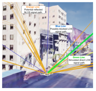
EL1-136 - AI‑Generated GNSS Multipath Digital Twins for Drone‑Based Infrastructure Inspection, Planning, and Safety Assurance
UAV inspection in ports, energy corridors, bridges, rail yards, industrial plants, and urban canyons is limited today because GNSS multipath and NLOS can push horizontal errors from sub‑meter to several meters, causing navigation dropouts and wrong geo‑tagging exactly where drones fly closest to obstacles. Operators currently lack high-fidelity tools able to accurately characterise site‑wide,…
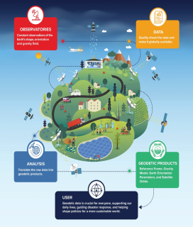
EL1-135 - Resilient Geodetic Infrastructure for Next-Generation PNT
The geodetic infrastructure, often referred to as the Geodesy Supply Chain (GSC), provides the foundation for precise Positioning, Navigation and Timing (PNT) and underpins a wide range of space and societal applications. However, it is largely operated on a best-effort basis, with fragmented governance and not fully coordinated holistic approach, resulting in a mismatch with the resilience…
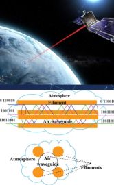
134 - All-weather Laser Timing and Ranging Links for Optical PNT Systems
Optical laser communication links from satellite to ground are affected by atmospheric conditions. When penetrating through clouds, optical signals suffer from power degradation up to complete loss of the satellite-to-ground link. As a result, optical ground stations (OGS) as used in the OpSTAR activity are not able to establish optical links continuously but will instead have data gaps. The…

133 - Resilient PNT by a combined GNSS/eLoran/INS approach for U-space applications
EC Regulation 2021/664 defines a minimum set of requirements for the Unmanned Aircraft Systems (UAS) operations in certain geographical zones, which is called U-space. U-space defines new services relying on a high level of digitalisation and automation, designed to provide access to airspace for large numbers of unmanned aircraft. Emerging U‑space Beyond Visual Line of Sight (BVLOS) operations,…